The Land of Volcanoes, Glaciers, and Mars-Like Deserts
Photographer Feodor Pitcairn ventured through serene and volatile landscapes to piece together a geological portrait of Iceland.
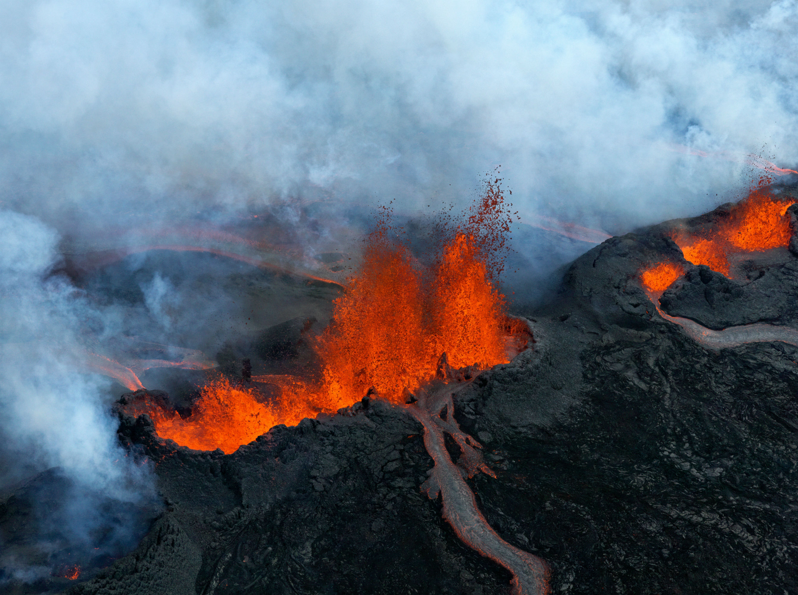
Photographer Feodor Pitcairn and geophysicist Ari Trausti Guðmundsson flew above an erupting Bárðarbunga fissure, pictured here, in September 2014. The Bárðarbunga system is Iceland's largest, spanning 120 miles in length. Photo by Feodor Pitcairn/courtesy of PowerHouse Books
Vicious winds whipped dark clouds of dust around the peaks of Bárðarbunga, the largest volcanic system in Iceland. The strong gusts prevented three men in a helicopter from choking on sulfur dioxide emanating from a fissure in the throes of an eruption that would span from late August 2014 into February 2015. While the pilot scouted for a safe spot to land, photographer and naturalist Feodor Pitcairn hung out of the chopper by the straps of a harness, focusing a Hasselblad camera on the gushing geysers and crawling rivers of lava beneath him. He was witnessing the birth of a new landscape.
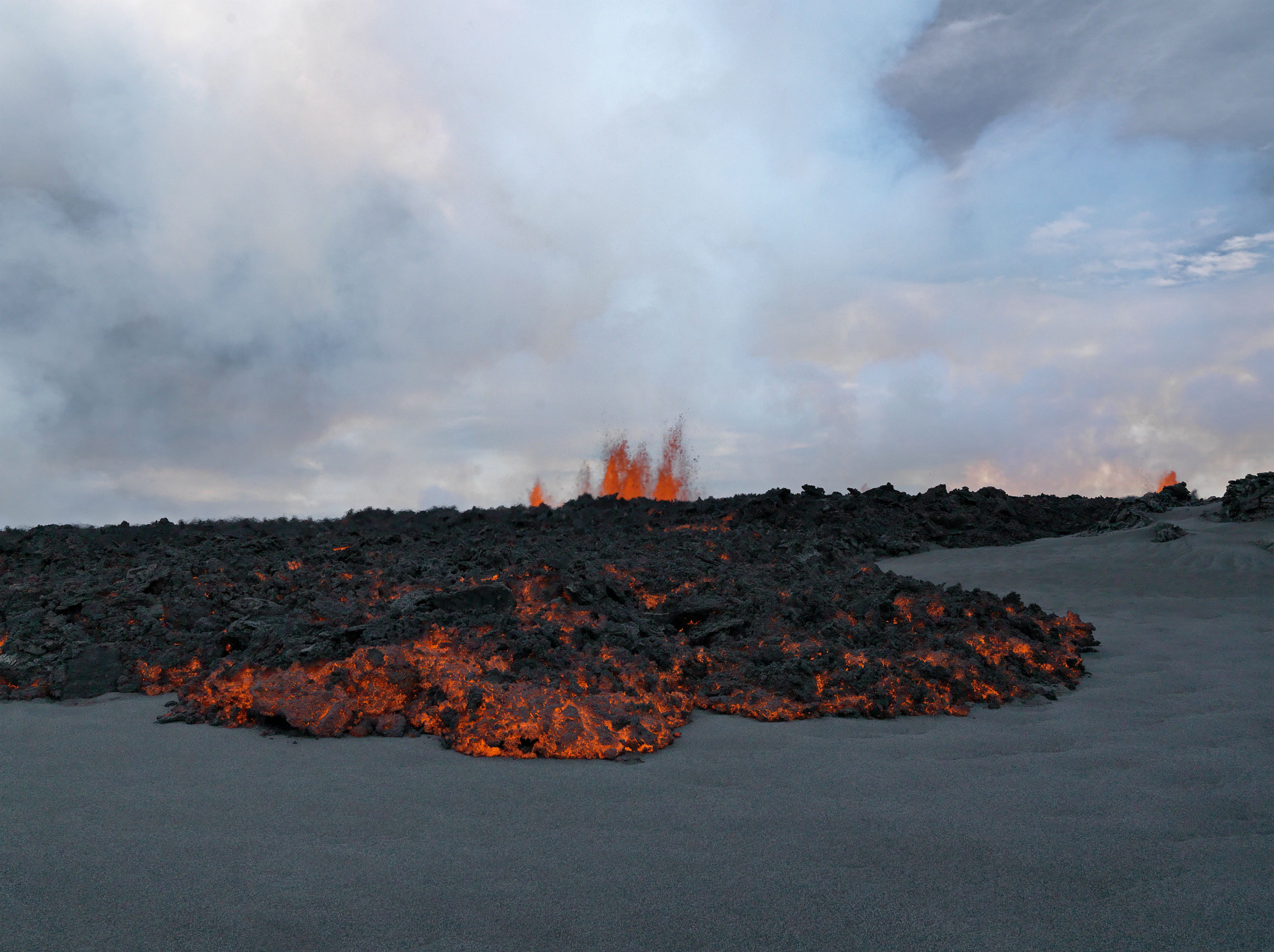
Guðmundsson and Pitcairn walked over fingers of lava deep under the sand. Photo by Feodor Pitcairn/courtesy of PowerHouse Books
“It was a little bit like the Apollo landing trying to find a good place to land with the lava going 300 feet in the air,” says Pitcairn, whose images appear in the new book Primordial Landscapes: Iceland Revealed and related exhibit at the Smithsonian National Museum of Natural History (on view until April 2017). “I don’t know how to describe it—being alone in that kind of landscape, when something like that was happening,” he says. “You feel very, very small.”
The expedition, which took place in early September of last year, was just one of many adventures Pitcairn has had in Iceland. Since he first visited the country in 2011, he’s logged eight trips and many thousands of miles to capture vistas of black beaches, glacial rivers, and cold deserts on camera. Iceland is “a real diamond of diversity,” he says.
A glacier icefall at the foot of the volcano Eyjafjallajökull, located on the southernmost tip of the island. Photo by Feodor Pitcairn/courtesy of PowerHouse Books
Iceland is a manifestation of plate tectonic activity along a 10,000-mile underwater mountain range called the Mid-Atlantic Ridge. The island, which is about the size of the state of Kentucky, is only 15-20 million years old, making it one of the youngest landmasses of its size in the world, according to Ari Trausti Guðmundsson, a geophysicist, poet, and former Iceland presidential candidate.
“If you hop over to Greenland, the bedrock is over 3,000 million years old,” says Guðmundsson, who guided Pitcairn during his expedition to Bárðarbunga and wrote the text, including 120 poems, in his book. “In comparison, Iceland is an infant.”
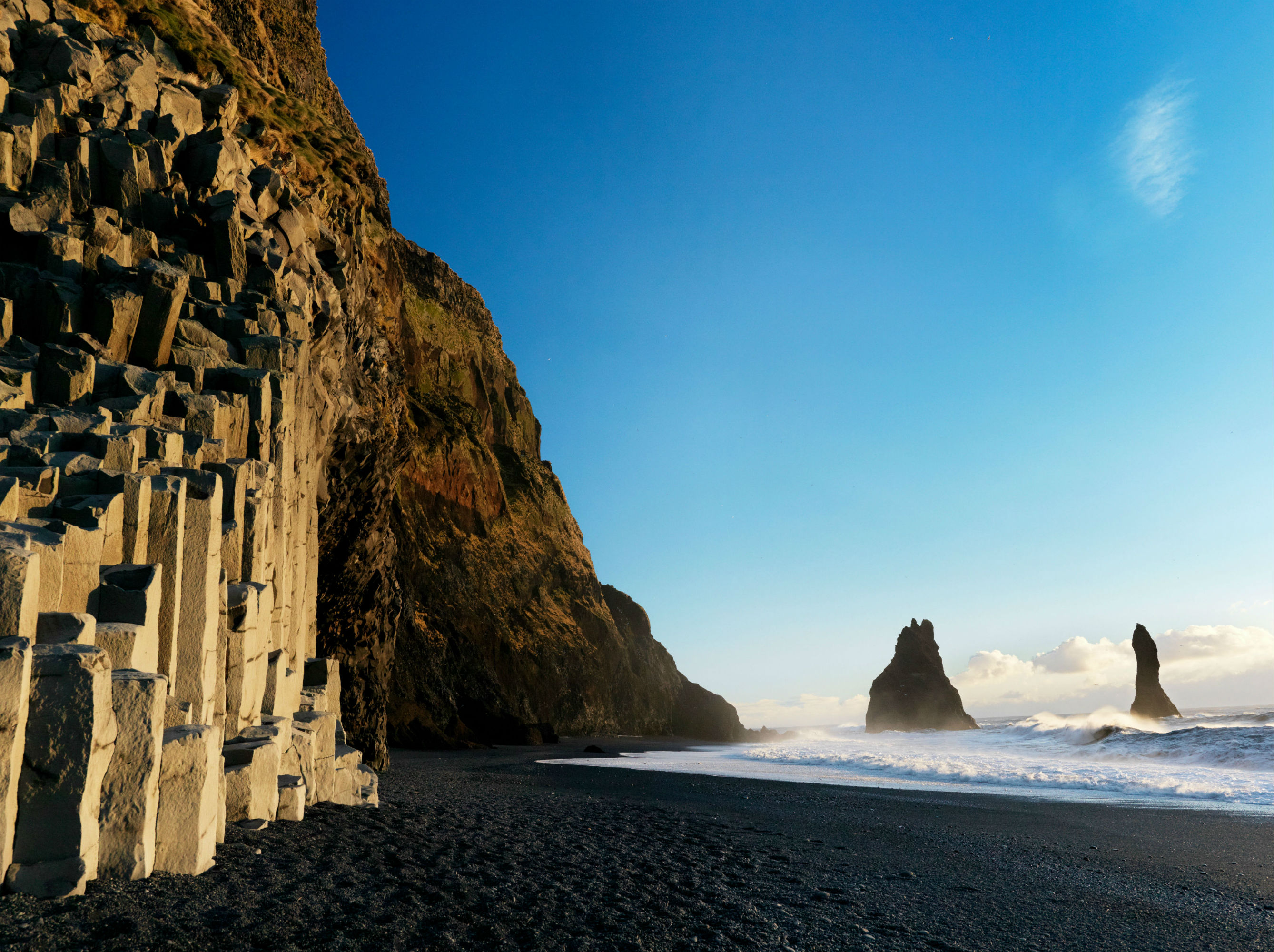
This southern Icelandic coastal feature, called Mt. Reynisfjall, was formed by columnar basalt, or fractured columns, which form when thick lava flows cool, contract, and crack. Photo by Feodor Pitcairn/courtesy of PowerHouse Books
The Mid-Atlantic Ridge gives rise to Iceland’s volcanoes, one of its signature geological features. The country boasts 30 volcanic systems, which contain hundreds of active volcanoes. The natural upwelling of magma from beneath the ridge, as well as a mantle plume located almost right under the middle of the country, send billions of tons of lava surging through the bedrock annually, causing the country to expand about one inch per year, on average, according to Guðmundsson.
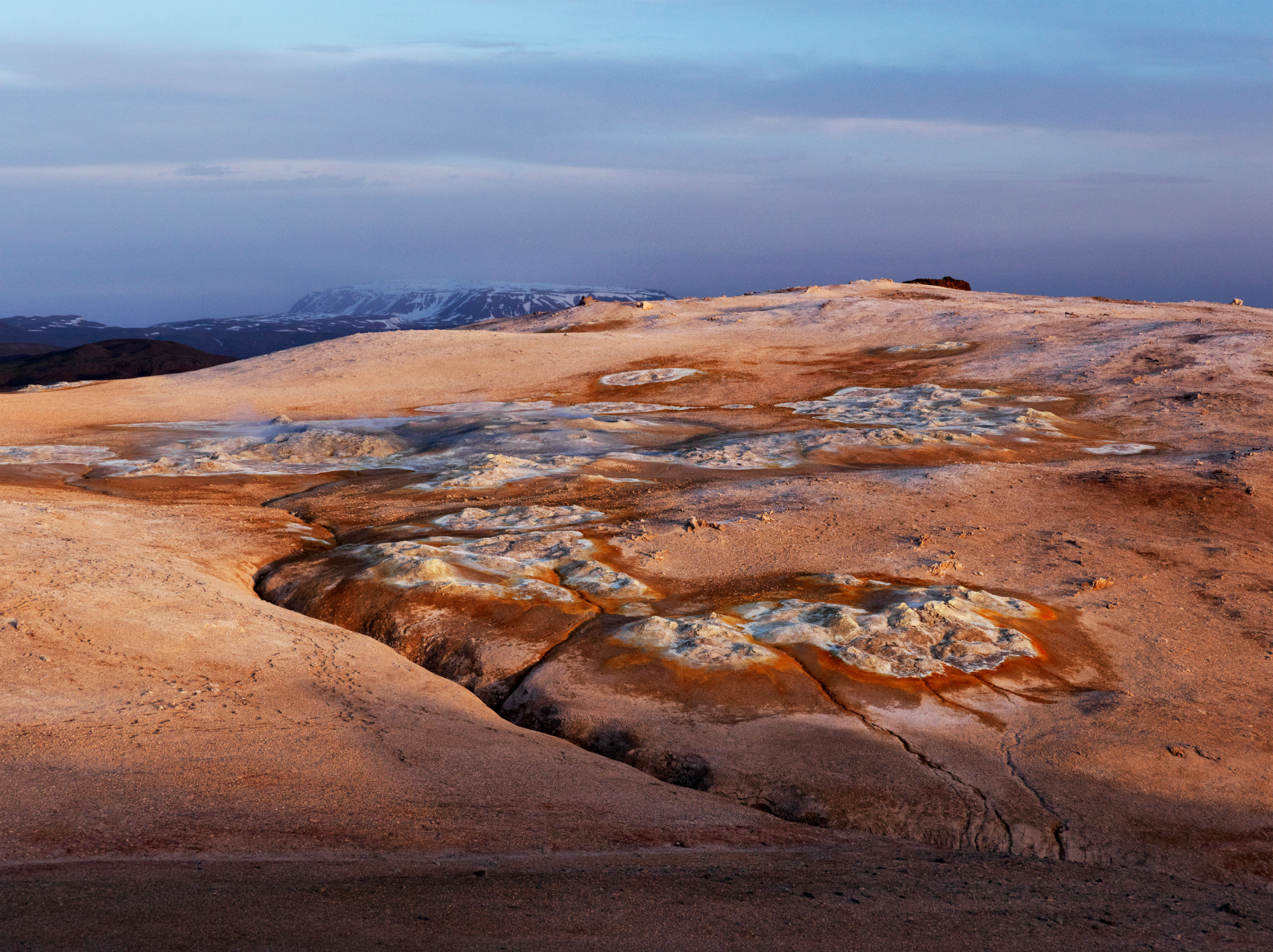
Mt. Námafjall’s flat top reveals geothermal vents and mudpots surrounded by clays and chemical deposits, such as sulfur, silica, and iron sulfide. Photo by Feodor Pitcairn/courtesy of PowerHouse Books
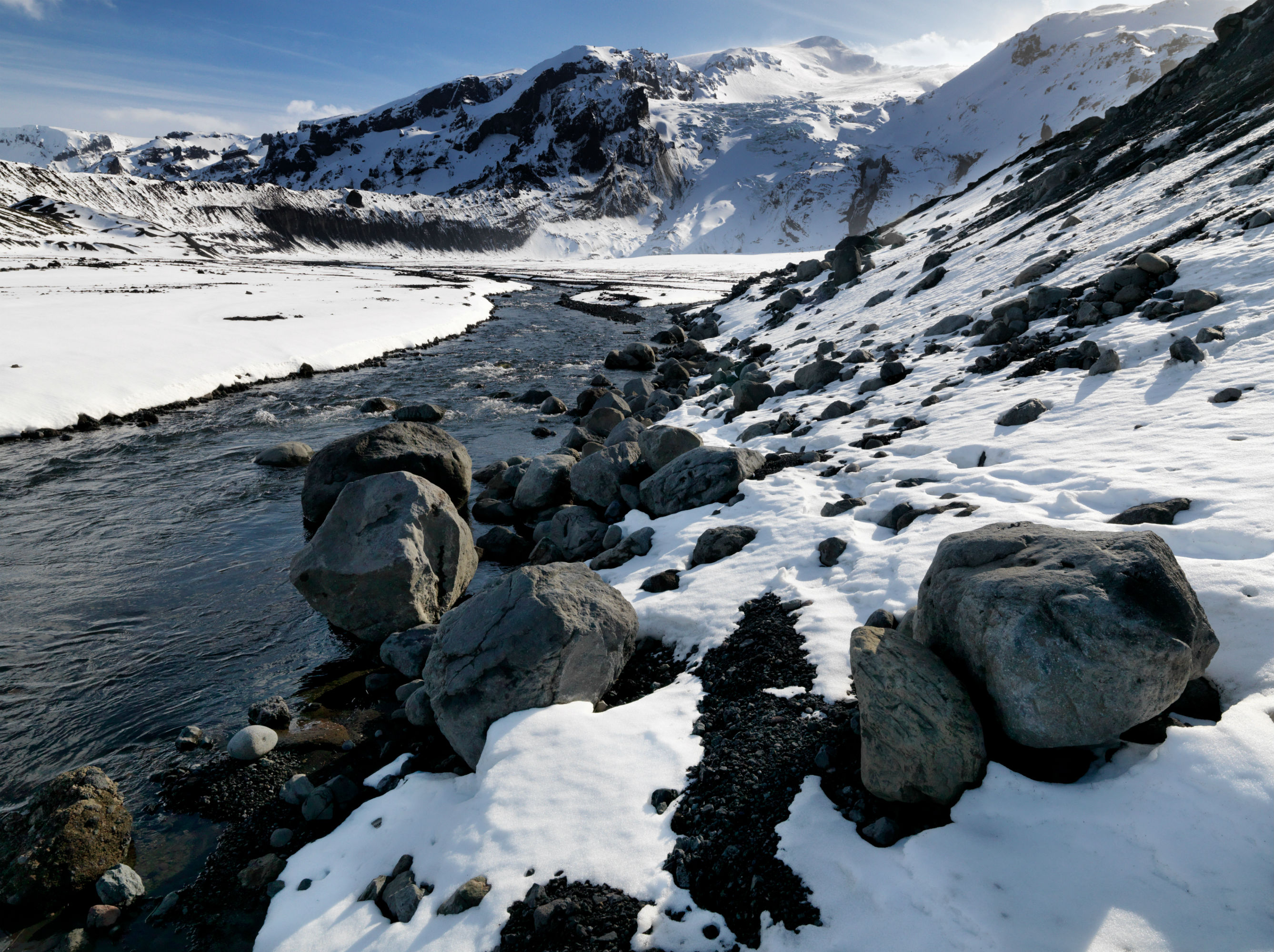
Iceland’s glacial past dates back around 3 million years, to the beginning of the current ice age, according to Guðmundsson. Since then, the island has experienced about 20 glacial periods that ensconced most of the country in ice. During warmer periods, melting glaciers carved fjords, valleys, and canyons, and created rivers that eventually dried into rocky deserts.
“These empty spaces and vast mountains remind people of something alien, something out of this world,” says Guðmundsson. Indeed, Iceland’s otherworldly terrain has been a believable backdrop in multiple science fiction movies, such as Star Trek: Into Darkness and Interstellar. Its deserts have also served as geological training grounds for astronauts and rovers. The terrain—speckled with cold, round stones and bereft of vegetation—is reminiscent of the surface of Mars or the moon, and provides a suitable environment for astronauts to test their equipment.
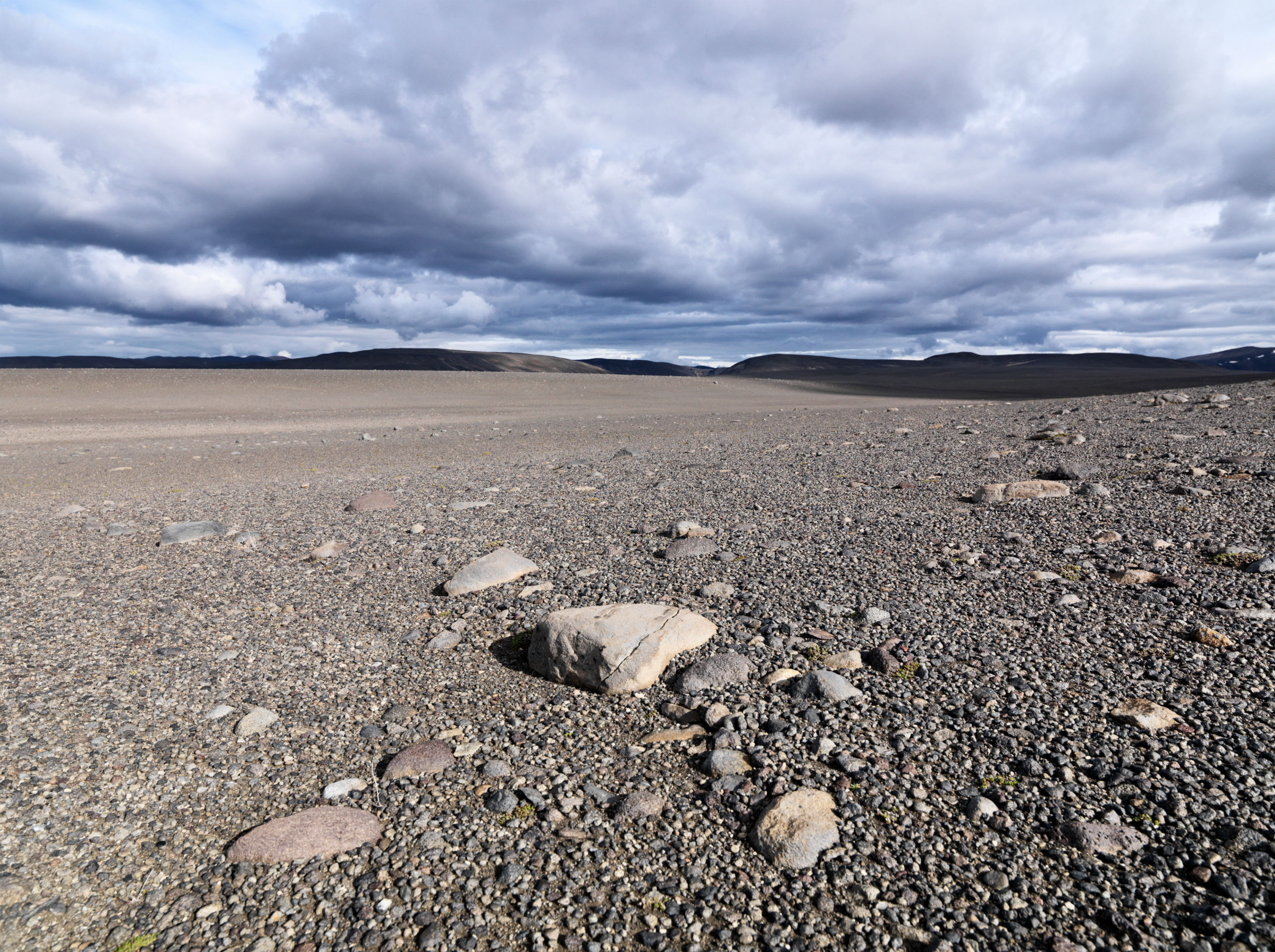
Cold deserts that dominate Iceland’s central highlands are products of dried rivers and receded Ice Age glaciers. Guðmundsson compares these environments to the surfaces on Mars and the moon. Photo by Feodor Pitcairn/courtesy of PowerHouse Books
The geophysical processes that shape Iceland’s terrain are valuable renewable energy sources, too, enabling the country to run entirely on green energy. When rainwater seeps into the volcanic bedrock, it heats up, turning into steam that puffs through geothermal vents. Engineers drill wells to harness that steam in order to generate domestic heating for the entire population. Additionally, glacial rivers power hydropower plants, which contribute 75 percent of the country’s electricity, with the rest coming from geothermal energy.
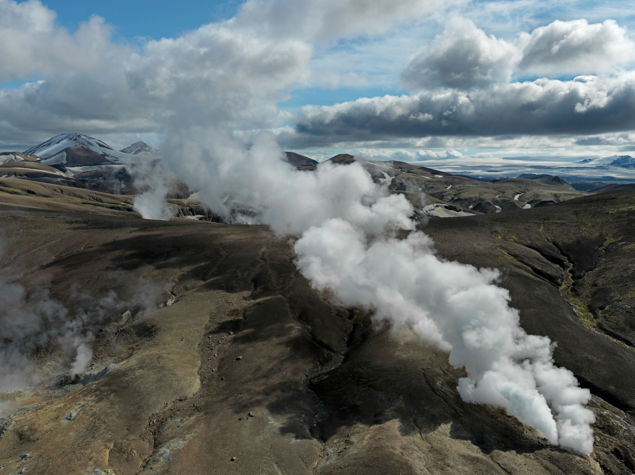
This region of the Torfajökull volcanic system is abundant with steam plumes from geothermal fields. Photo by Feodor Pitcairn/courtesy of PowerHouse Books
As Guðmundsson writes in Primordial Landscapes, Iceland is “a land truly in the making,” and one that will continue to evolve as the climate changes. For example, global warming has caused a rapid recession of the glaciers—up to 0.2-0.3 percent of mass per year. As the ice cover thins, glaciated volcanoes will erupt more frequently, and glacial rivers will swell, according to Guðmundsson. Glaciers cover 11 percent of the country’s land today, but “in another 150 to 200 years, they will almost be gone,” he says. “The name ‘Iceland’ will probably not be so apt anymore.”
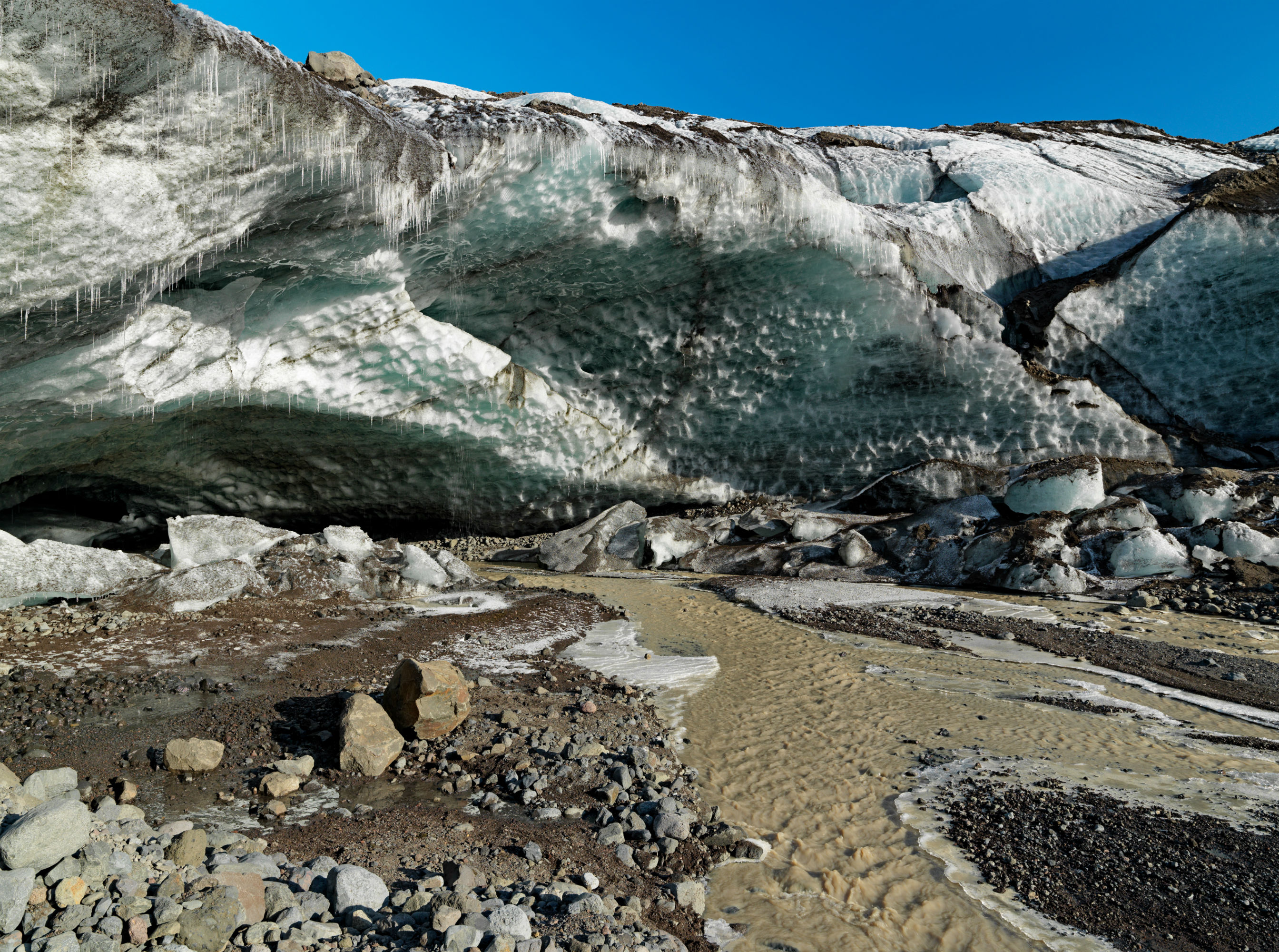
This is the edge of a retreating glacier—a sign of global warming’s effect on glacial ice. Photo by Feodor Pitcairn/courtesy of PowerHouse Books
But from underneath the retreating ice, new land formations and vegetation will emerge over decades and centuries, according to Guðmundsson, creating new ecosystems. “Global warming is affecting us in many ways,” he says. “It’s not a win-win situation. It’s a win and lose situation.”
Lauren J. Young was Science Friday’s digital producer. When she’s not shelving books as a library assistant, she’s adding to her impressive Pez dispenser collection.